
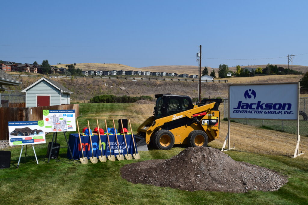
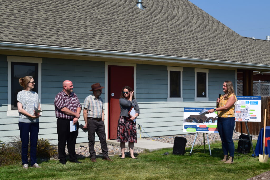
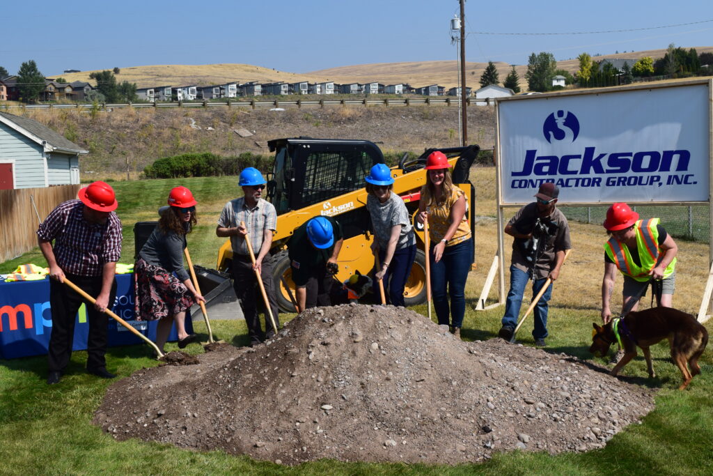
Missoula Animal Services Expansion & Remodel

Missoula Animal Services saves 97% of the animals in their care between adoptions and reuniting pets with owners. The remodeled shelter will keep animals physically and mentally healthy for as long as it takes to meet their loving families.

This expansion offers opportunities to make donations in memory of pets or loved ones as well as several naming opportunities in newly built and remodeled rooms. Donations may also be made in the form of investment securities or bank transfers.

For more information contact Graham Roy, Development Coordinator, at groy@missoulacounty.us (406) 880-6538

Why is this project needed?

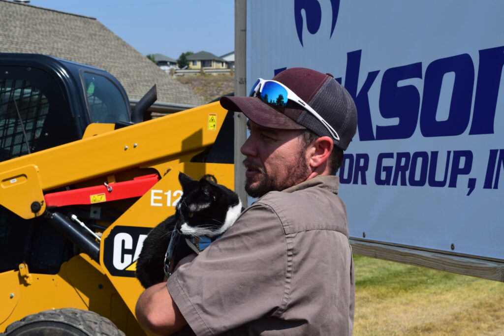
The Missoula Animal Control expansion project will give staff better workspaces, reduce overcrowding and noise within the shelter, improve animal housing, creating essential areas for the public like meet and greet rooms, and update animal housing. This will enhance the overall effectiveness of the shelter and improve the quality of life for both the animals and the staff.

What will the project look like?
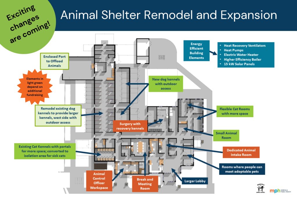
For the animals: 

  • A new, separate room for small animals (will reduce stress if they can be away from cats and dogs) 
  • Adding several flexible cat rooms with larger cages and access to a future outdoor space (e.g., a cat patio also known as a Catio).  Limiting the number of cats in a space and giving them larger cages reduces stress and sickness caused by stress.  In turn, cats can be adopted out more quickly.  
  • Convert existing cat room to an isolation area for sick cats, with larger cat cages. 
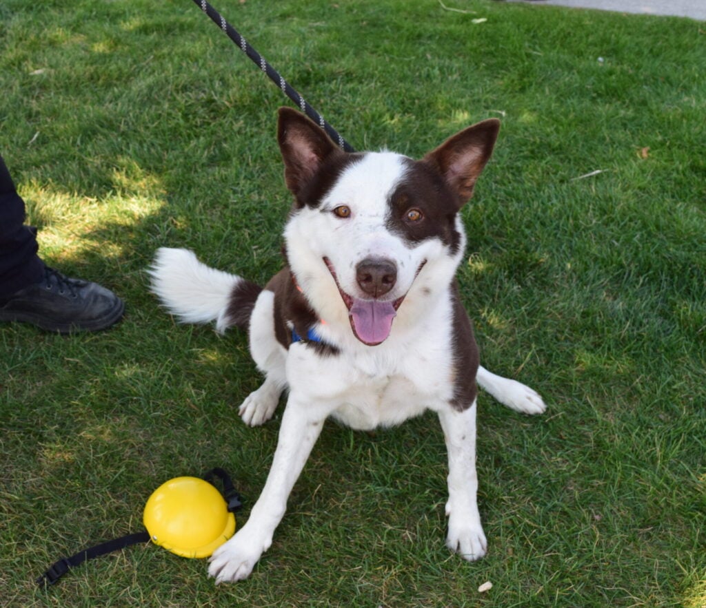
  • Add new dog kennels with ready access to the outside.  This setup will reduce stress on the dogs, improving their life while they’re at the shelter.  That also helps them get adopted more quickly. 

For the public: 

  • Larger lobby area
  • Small rooms for meet and greets with adoptable animals 
  • Small rooms to say good-bye to an animal being surrendered
  • Access to adoptable cats and dogs 
  • A small animal room to visit bunnies, guinea pigs, birds, etc. away from dogs and cats

For the staff:

  • Small break and meeting room 
  • Dedicated surgery room with observation kennels for animals in recovery 
  • Separate room for Animal Control Officers
  • Conveniently located, dedicated animal intake room 

The following two parts of this project are not currently funded.  We hope to be able to raise the money to include them: 

  • Remodel the existing kennels so that dogs either have access to the outside or a separate place for them to potty. 
  • Add an enclosed port to offload animals when Animal Control Officers bring them to the shelter. This will reduce stress on the animals and reduce the potential for escapes. The latter is especially important considering how close the shelter is to the interstate.    
How is the project funded?

Missoula City-County Animal Control is part of the Environmental Health Division of Missoula Public Health. The city and county cooperate through an interlocal agreement, which specifies each will be responsible for 50% of the cost of a shelter building project.  The project is being funded through a combination of ARPA (federal) funding, grants, and financing.  We have also committed to raising $1 million in donations or grants to keep the project affordable. 

We need your help! All donations to this project are tax deductible. Your contribution will go directly to the shelter remodel and expansion and help animals in the Missoula community!


\r\n\r\n<\/div>"},"imageFolderURL":"https:\/\/missoulapublichealth.org\/wp-content\/plugins\/wp-google-maps\/images\/","resturl":"https:\/\/missoulapublichealth.org\/wp-json\/wpgmza\/v1","restnonce":"008c556425","restnoncetable":{"\/(polygons|polylines|circles|rectangles|pointlabels)(\\\/\\d+)?\/":"02d6d3d3ff","\/markers(\\\/\\d+)?\/":"e1bd43351d","\/datatables":"cc1157b5e5"},"settings":{"engine":"google-maps","internal_engine":"legacy","google_maps_api_key":false,"default_marker_icon":"https:\/\/missoulapublichealth.org\/wp-content\/plugins\/wp-google-maps\/images\/spotlight-poi3.png","developer_mode":false,"user_interface_style":"default","wpgmza_gdpr_enabled":1,"wpgmza_gdpr_default_notice":"

\r\n\tI agree for my personal data to be processed by <\/span>, for the purpose(s) of <\/span>.\r\n<\/p>\r\n\r\n

\t\r\n\tI agree for my personal data, provided via map API calls, to be processed by the API provider, for the purposes of geocoding (converting addresses to coordinates), reverse geocoding and\tgenerating directions.\r\n<\/p>\r\n

\r\n\tSome visual components of WP Go Maps use 3rd party libraries which are loaded over the network. At present the libraries are Google Maps, Open Street Map, jQuery DataTables and FontAwesome. When loading resources over a network, the 3rd party server will receive your IP address and User Agent string amongst other details. Please refer to the Privacy Policy of the respective libraries for details on how they use data and the process to exercise your rights under the GDPR regulations.\r\n<\/p>\r\n

\r\n\tWP Go Maps uses jQuery DataTables to display sortable, searchable tables, such as that seen in the Advanced Marker Listing and on the Map Edit Page. jQuery DataTables in certain circumstances uses a cookie to save and later recall the \"state\" of a given table - that is, the search term, sort column and order and current page. This data is held in local storage and retained until this is cleared manually. No libraries used by WP Go Maps transmit this information.\r\n<\/p>\r\n

\r\n\tPlease see here<\/a> and here<\/a> for Google's terms. Please also see Google's Privacy Policy<\/a>. We do not send the API provider any personally identifying information, or information that could uniquely identify your device.\r\n<\/p>\r\n

\r\n\tWhere this notice is displayed in place of a map, agreeing to this notice will store a cookie recording your agreement so you are not prompted again.\r\n<\/p>","wpgmza_gdpr_company_name":"Missoula Public Health","wpgmza_gdpr_retention_purpose":"displaying map tiles, geocoding addresses and calculating and display directions.","wpgmza_gdpr_button_label":"I agree","wpgmza_marker_xml_url":"https:\/\/missoulapublichealth.org\/wp-content\/uploads\/wp-google-maps\/","wpgmza_maps_engine":"google-maps","wpgmza_maps_engine_dialog_done":true,"wpgmza_google_maps_api_key":"QUl6YVN5QXJINkVnQ0JBd3NBX3JybjBtVWhJVng4elFUSkU1MlIw","tile_server_url":"https:\/\/{a-c}.tile.openstreetmap.org\/{z}\/{x}\/{y}.png","action":"wpgmza_save_settings","wpgmza_settings_map_full_screen_control":false,"wpgmza_settings_map_streetview":false,"wpgmza_settings_map_zoom":false,"wpgmza_settings_map_pan":false,"wpgmza_settings_map_type":false,"wpgmza_settings_map_tilt_controls":false,"wpgmza_settings_map_scroll":false,"wpgmza_settings_map_draggable":false,"wpgmza_settings_map_clickzoom":false,"wpgmza_settings_cat_logic":"0","wpgmza_settings_filterbycat_type":"1","use_fontawesome":"4.*","tile_server_url_override":"","wpgmza_load_engine_api_condition":"where-required","wpgmza_always_include_engine_api_on_pages":"","wpgmza_always_exclude_engine_api_on_pages":"","wpgmza_prevent_other_plugins_and_theme_loading_api":false,"wpgmza_settings_access_level":"manage_options","wpgmza_settings_retina_width":"","wpgmza_settings_retina_height":"","wpgmza_force_greedy_gestures":false,"disable_lightbox_images":false,"gallery_item_source_size":null,"wpgmza_settings_image_resizing":false,"wpgmza_settings_image_width":"","wpgmza_settings_image_height":"","wpgmza_settings_infowindow_width":"","wpgmza_settings_infowindow_links":false,"wpgmza_settings_infowindow_address":false,"infowindow_hide_category":false,"wpgmza_settings_infowindow_link_text":"","wpgmza_settings_map_open_marker_by":"1","wpgmza_settings_disable_infowindows":false,"wpgmza_settings_markerlist_icon":false,"wpgmza_settings_markerlist_link":false,"wpgmza_settings_markerlist_title":false,"wpgmza_settings_markerlist_address":false,"wpgmza_settings_markerlist_category":false,"wpgmza_settings_markerlist_description":false,"wpgmza_do_not_enqueue_datatables":false,"wpgmza_default_items":null,"wpgmza_settings_carousel_markerlist_theme":null,"wpgmza_settings_carousel_markerlist_image":false,"wpgmza_settings_carousel_markerlist_title":false,"wpgmza_settings_carousel_markerlist_icon":false,"wpgmza_settings_carousel_markerlist_address":false,"wpgmza_settings_carousel_markerlist_description":false,"wpgmza_settings_carousel_markerlist_marker_link":false,"wpgmza_settings_carousel_markerlist_directions":false,"wpgmza_settings_carousel_markerlist_resize_image":false,"carousel_lazyload":false,"carousel_autoheight":false,"carousel_pagination":false,"carousel_navigation":false,"wpgmza_do_not_enqueue_owl_carousel":false,"wpgmza_do_not_enqueue_owl_carousel_themes":false,"carousel_items":"5","carousel_items_tablet":"3","carousel_items_mobile":"1","carousel_autoplay":"5000","wpgmza_store_locator_radii":"","importer_google_maps_api_key":"","open_layers_api_key":"","open_route_service_key":"","wpgmza_settings_marker_pull":"0","wpgmza_custom_css":"","wpgmza_custom_js":"","disable_compressed_path_variables":false,"disable_autoptimize_compatibility_fix":false,"enable_dynamic_sql_refac_filter":false,"disable_automatic_backups":false,"disable_google_fonts":false,"wpgmza_developer_mode":false,"wpgmza_gdpr_require_consent_before_load":false,"wpgmza_gdpr_override_notice":false,"wpgmza_gdpr_notice_override_text":"","accessLevel":"manage_options","alwaysExcludeEngineApiOnPages":"","alwaysIncludeEngineApiOnPages":"","carouselAutoplay":"5000","carouselItems":"5","carouselItemsMobile":"1","carouselItemsTablet":"3","carouselMarkerlistResizeImage":false,"carouselTheme":null,"categoryFilterDisplay":"dropdown","categoryFilteringLogic":"or","customCss":"","customJs":"","defaultMarkerIcon":"https:\/\/missoulapublichealth.org\/wp-content\/plugins\/wp-google-maps\/images\/spotlight-poi3.png","developerMode":false,"disableAutomaticBackups":false,"disableAutoptimizeCompatibilityFix":false,"disableCompressedPathVariables":false,"disableDoubleClickZoom":false,"disableDragPanning":false,"disableFullScreenControl":false,"disableGoogleFonts":false,"disableInfoWindows":false,"disableLightboxImages":false,"disableMouseWheelZoom":false,"disablePanControl":false,"disableStreetViewControl":false,"disableTypeControl":false,"disableZoomControl":false,"doNotEnqueueDatatables":false,"doNotEnqueueOwlCarousel":false,"doNotEnqueueOwlCarouselThemes":false,"enableCarouselAutoHeight":false,"enableCarouselLazyLoad":false,"enableCarouselNavigation":false,"enableCarouselPagination":false,"enableDynamicSqlRefacFilter":false,"forceGreedyGestures":false,"galleryItemSourceSize":null,"gdprButtonLabel":"I agree","gdprCompanyName":"Missoula Public Health","gdprDefaultNotice":"

\r\n\tI agree for my personal data to be processed by <\/span>, for the purpose(s) of <\/span>.\r\n<\/p>\r\n\r\n

\t\r\n\tI agree for my personal data, provided via map API calls, to be processed by the API provider, for the purposes of geocoding (converting addresses to coordinates), reverse geocoding and\tgenerating directions.\r\n<\/p>\r\n

\r\n\tSome visual components of WP Go Maps use 3rd party libraries which are loaded over the network. At present the libraries are Google Maps, Open Street Map, jQuery DataTables and FontAwesome. When loading resources over a network, the 3rd party server will receive your IP address and User Agent string amongst other details. Please refer to the Privacy Policy of the respective libraries for details on how they use data and the process to exercise your rights under the GDPR regulations.\r\n<\/p>\r\n

\r\n\tWP Go Maps uses jQuery DataTables to display sortable, searchable tables, such as that seen in the Advanced Marker Listing and on the Map Edit Page. jQuery DataTables in certain circumstances uses a cookie to save and later recall the \"state\" of a given table - that is, the search term, sort column and order and current page. This data is held in local storage and retained until this is cleared manually. No libraries used by WP Go Maps transmit this information.\r\n<\/p>\r\n

\r\n\tPlease see here<\/a> and here<\/a> for Google's terms. Please also see Google's Privacy Policy<\/a>. We do not send the API provider any personally identifying information, or information that could uniquely identify your device.\r\n<\/p>\r\n

\r\n\tWhere this notice is displayed in place of a map, agreeing to this notice will store a cookie recording your agreement so you are not prompted again.\r\n<\/p>","gdprEnabled":1,"gdprNoticeOverrideText":"","gdprOverrideNotice":false,"gdprRequireConsentBeforeLoad":false,"gdprRetentionPurpose":"displaying map tiles, geocoding addresses and calculating and display directions.","googleMapsApiKey":"QUl6YVN5QXJINkVnQ0JBd3NBX3JybjBtVWhJVng4elFUSkU1MlIw","hideCarouselMarkerListingAddress":false,"hideCarouselMarkerListingDescription":false,"hideCarouselMarkerListingDirections":false,"hideCarouselMarkerListingIcon":false,"hideCarouselMarkerListingImage":false,"hideCarouselMarkerListingLink":false,"hideCarouselMarkerListingTitle":false,"hideMarkerListingAddress":false,"hideMarkerListingCategory":false,"hideMarkerListingDescription":false,"hideMarkerListingIcon":false,"hideMarkerListingLink":false,"hideMarkerListingTitle":false,"importerGoogleMapsApiKey":"","infoWindowAddress":false,"infoWindowHideCategory":false,"infoWindowImageHeight":"","infoWindowImageResizing":false,"infoWindowImageWidth":"","infoWindowLinkText":"","infoWindowLinks":false,"infoWindowMaxWidth":"","internalEngine":"legacy","loadEngineApiCondition":"where-required","mapTiltControls":false,"mapsEngineDialogDone":true,"markerListingPageSize":null,"markerPull":"database","markerXmlUrl":"https:\/\/missoulapublichealth.org\/wp-content\/uploads\/wp-google-maps\/","openInfoWindowEvent":"click","openLayersApiKey":"","openRouteServiceKey":"","preventOtherPluginsAndThemeLoadingApi":false,"retinaHeight":"","retinaWidth":"","storeLocatorRadii":"","tileServerUrl":"https:\/\/{a-c}.tile.openstreetmap.org\/{z}\/{x}\/{y}.png","tileServerUrlOverride":"","useFontAwesome":"4.*","userInterfaceStyle":"default"},"stylingSettings":{},"currentPage":null,"userCanAdministrator":"0","serverCanInflate":"1","localized_strings":{"unsecure_geolocation":"Many browsers are no longer allowing geolocation from unsecured origins. You will need to secure your site with an SSL certificate (HTTPS) or this feature may not work for your visitors","use_my_location":"Use my location","google_api_not_loaded":"The map cannot be initialized because the Maps API has not been loaded. Please check your settings.","no_google_maps_api_key":"You have not entered a Google Maps API Key<\/b>.

Please go to the your admin area, then Maps, then Settings, then the Advanced tab to
enter your Google Maps API key<\/a>.

Alternatively,
choose the Open Layers engine<\/a> to avoid getting an API key.","documentation":"Documentation","api_dashboard":"API Dashboard","verify_project":"Verify Project","no_shape_circle":"Please create the circle first.","no_shape_rectangle":"Please create the rectangle first.","no_shape_polygon":"Please create the polygon first.","no_shape_polyline":"Please create the polyline first.","failed_to_get_address":"Failed to get address","failed_to_create_marker":"Failed to create marker %d - this marker cannot be placed on the map.","my_location":"My Location","kilometers_away":"km away","miles_away":"miles away","import_completed":"Import completed.","importing_please_wait":"Importing, this may take a moment...","no_address_specified":"No address specified","add_marker":"Add Marker","save_marker":"Save Marker","please_wait":"Please Wait...","zero_results":"No results found in this location. Please try again.","address_not_found":"This address could not be found. WP Go Maps uses a 3rd party service (eg Google) to convert addresses to geographic coordinates. Unfortunately, the service has no records for this address at present. Please try an alternative format, or manually position the marker using right click.","geocode_fail":"Geocode failed due to technical reasons","you_must_check_gdpr_consent":"You must check the GDPR consent box to continue","no_gps_coordinates":"No GPS coordinates found","fetching_directions":"Fetching directions...","unknown_directions_service_status":"Unknown directions service status","please_fill_out_both_from_and_to_fields":"Please fill out both the \"from\" and \"to\" fields","no_picture_found":"No picture found","overwrite_theme_data":"Are you sure you want to overwrite the existing theme data?","upload_complete":"Upload Complete","uploading_file":"Uploading file","bulk_jpeg_media_title":"WP Go Maps - Bulk JPEG Upload","from_your_location":"from your location","from_searched_location":"from searched location","yes":"Yes","no":"No","requires_gold_v5":"Requires WP Go Maps - Gold add-on 5.0.0 or above","confirm_remove_duplicates":"This operation is not reversable. We recommend you take a backup before proceeding. Would you like to continue?","invalid_theme_data":"Invalid theme data","duplicate_custom_field_name":"Duplicate custom field names, please ensure you only add unique custom field names.","disabled_interactions_notice":"Some interactions are disabled.","interactions_enabled_notice":"Interactions Enabled","disabled_interactions_button":"Re-Enable Interactions","use_two_fingers":"Use two fingers to move the map","use_ctrl_scroll_to_zoom":"Use ctrl + scroll to zoom the map","geocode_was_not_successful":"Geocode was not successful for the following reason: ","geocoding_library_notice":"Geocoding this address failed. Please check you have enabled the Geocoding API for your Google Maps API project.","map_delete_prompt_text":"Are you sure you want to delete this map?","map_bulk_delete_prompt_text":"Are you sure you want to delete these maps?","general_delete_prompt_text":"Are you sure you want to delete this data?","new_map":"New Map","all":"All","cloud_api_key_error_1":"Autocomplete disabled. Find out more<\/a>."},"api_consent_html":"

\r\n\tI agree for my personal data to be processed by Missoula Public Health<\/span>, for the purpose(s) of displaying map tiles, geocoding addresses and calculating and display directions.<\/span>.\r\n<\/p>\r\n\r\n

\t\r\n\tI agree for my personal data, provided via map API calls, to be processed by the API provider, for the purposes of geocoding (converting addresses to coordinates), reverse geocoding and\tgenerating directions.\r\n<\/p>\r\n

\r\n\tSome visual components of WP Go Maps use 3rd party libraries which are loaded over the network. At present the libraries are Google Maps, Open Street Map, jQuery DataTables and FontAwesome. When loading resources over a network, the 3rd party server will receive your IP address and User Agent string amongst other details. Please refer to the Privacy Policy of the respective libraries for details on how they use data and the process to exercise your rights under the GDPR regulations.\r\n<\/p>\r\n

\r\n\tWP Go Maps uses jQuery DataTables to display sortable, searchable tables, such as that seen in the Advanced Marker Listing and on the Map Edit Page. jQuery DataTables in certain circumstances uses a cookie to save and later recall the \"state\" of a given table - that is, the search term, sort column and order and current page. This data is held in local storage and retained until this is cleared manually. No libraries used by WP Go Maps transmit this information.\r\n<\/p>\r\n

\r\n\tPlease see here<\/a> and here<\/a> for Google's terms. Please also see Google's Privacy Policy<\/a>. We do not send the API provider any personally identifying information, or information that could uniquely identify your device.\r\n<\/p>\r\n

\r\n\tWhere this notice is displayed in place of a map, agreeing to this notice will store a cookie recording your agreement so you are not prompted again.\r\n<\/p>