Weekend air quality wavered between Good and Moderate across the County and some areas even tipped into air quality that was Unhealthy for Sensitive Groups or Orange for a short period of time (Petty Creek!). Wildfires remained active over the weekend and high temperatures are in the forecast before rains come through later this week; stay up to date on fires in Montana at MTFireInfo.org and InciWeb.Wildfire.gov.
With several active fires practically triangulating Missoula County right now (Mire Fire, Island Creek Fire, Windy Rock, Knowles Fire), more smoke is expected but will likely stay light since most heavy smoke-producing fires aren’t very close in proximity (the exception is the Corral Creek Fire). Transport winds are forecasted to move smoke to the south which is great news for smoke produced by the numerous fires in the Bitterroots. On the other hand, northerly winds may transport smoke from the Knowles Fire into communities south such as the Ninemile area leading into Huson and Frenchtown. There is definitely still a concern of smoke draining into valleys during the evening and pooling overnight. Although we have some incoming storms this week, it doesn’t look like there’s a good cold front to push and move the smoke nor storms out quickly. Rain and storms can help with smoky air, but relief from smoke is more attributed to the wind produced from storms and not necessarily the rain. These slow storms forecasted don’t have as much potential to move and disperse smoke but can help some.
We’ve had some pretty cool evenings lately but tomorrow is supposed to be in the 90’s. Know that heat is a more immediate health threat than smoke, so remember to prioritize staying cool and then think about reducing your exposure to smoke. This may look like cooling down your home by opening windows, maybe letting some smoke inside, and then once your place has cooled some, closing the windows and running your HEPA air cleaner or MERV13 box fan filter. Learn about cleaning your indoor air and reducing your exposure to smoke at MontanaWildfireSmoke.org.
Also! Everyone should take a fresh look, or first look, at the Fire and Smoke Map. Over the past year, Missoula Public Health’s Air Program has installed a couple of new PurpleAir monitors to provide more localized air quality information to areas that did not have any coverage. PurpleAir’s are small air quality monitors that measure PM2.5, or particulate matter 2.5 microns in size. Wildfire smoke contains a whole slough of pollutants that are considered PM2.5; smoke is often much smaller than 2.5 microns in size which is why it poses such a health risk when inhaled. The new monitors are located in/at Petty Creek, Lolo, East Missoula, Marshall Mountain, Clearwater Junction, and Ninemile. A special thanks to our partners, Missoula County, local fire departments, and the Forest Service who are hosting these PurpleAir’s!
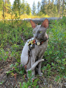
Missoula’s air quali-kitty, Mushu, is here to wrap up this update! She’s dreaming of finding those last huckleberries still up in the mountains, which is a great low-intensity outdoor activity when it’s a bit smoky. Air quality can change quickly at times, so check Fire.AirNow.Gov the for the most up to date air quality conditions near you!